Geospatial GeoJSON Queries
GeoJSON queries return documents that contain location in either legacy Geopoint format or standard GeoJSON, thus providing more utility than that of legacy point-distance, bounded-rectangle and bounded-polygon against the indexed Geopoint fields.
For these queries the Search service supports higher dimensional spatial structures that enable the users to approximate a large variety of real life shapes like a postal or jurisdictional region boundaries, a route for a delivery vehicle or an airline career or the boundaries of various water bodies like a river, lake, stream etc..
GeoJSON is a geospatial data interchange format based on JavaScript Object Notation (JSON). It defines several types of JSON objects and the manner in which they are combined to represent data about geographic features, their properties, and their spatial extents. GeoJSON uses a geographic coordinate reference system, World Geodetic System 1984, and units of decimal degrees.
Internally the Search service supports the GeoJSON spatial data formats on spherical geodesics via S2 cells. Furthermore the Search service adheres to the GeoJSON standard RFC 7946 allows users to address query use cases like:
-
Finding all the documents with any GeoJSON shapes that contains the spatial field of the query shape.
-
Finding all the documents with any GeoJSON shapes that are within the spatial field of the query shape.
-
Finding all the documents with any GeoJSON shapes that intersects the spatial field of the query shape.
The supported GeoJSON shapes in the Search service are:
-
Point (equivalent to a legacy Geopoint)
-
LineString
-
Polygon (equivalent to a legacy Polygon)
-
MultiPoint
-
MultiLineString
-
MultiPolygon
-
GeometryCollection
In addition to the above shapes, Search also supports a couple of additional custom shapes to make the spatial approximations easier for users to utilize. The two extra shapes supported are:
-
Circle (equivalent to a legacy Radius)
-
Envelope (equivalent to a legacy Rectangle)
Prerequisites - Modify the travel-sample dataset
The travel-sample bucket, provided for test and development, DOES NOT contains any GeoJSON constructs in the documents (only legacy Geopoint information) as such you will need to modify the travel-sample data to work with GeoJSON.
A dataset modification can be easily accomplished via either
-
Adding a new GeoJSON object(s) to your documents.
-
Converting Geopoints to GeoJSON Point types in your documents.
To run the examples in this documentation the first update method "Adding a new GeoJSON object(s) to your documents" is needed.
-
Example documents that have a geo field (airports, hotels or landmarks) such as
airport_1254intravel-sample._default._default:{ "airportname": "Calais Dunkerque", "city": "Calais", "country": "France", "faa": "CQF", "geo": { "alt": 12, "lat": 50.962097, "lon": 1.954764 }, "icao": "LFAC", "id": 1254, "type": "airport", "tz": "Europe/Paris" } -
Adding a new GeoJSON object(s) (required for running the examples)
Using SQL++ (or SQL++) in the Query Workbench we can quickly read the "geo" objects in
travel-sample._default._defaultand generate and add a new geojson object to each document. In addition the second statement will add a higher level GeoJSON (Couchbase addition to the spec) object representing a 10 mile radius around each airport (only for type=airport).UPDATE `travel-sample`._default._default SET geojson = { "type": "Point", "coordinates": [geo.lon, geo.lat] } WHERE geo IS NOT null; UPDATE `travel-sample`._default._default SET geoarea = { "coordinates": [geo.lon, geo.lat], "type": "circle", "radius": "10mi"} WHERE geo IS NOT null AND type="airport";After running the above conversion we would get updated documents for airports like (hotels and landmarks will not have a geoarea sub-object):
{ "airportname": "Calais Dunkerque", "city": "Calais", "country": "France", "faa": "CQF", "geo": { "alt": 12, "lat": 50.962097, "lon": 1.954764 }, "geoarea": { "coordinates": [ 1.954764, 50.962097 ], "radius": "10mi", "type": "circle" }, "geojson": { "coordinates": [ 1.954764, 50.962097 ], "type": "Point" }, "icao": "LFAC", "id": 1254, "type": "airport", "tz": "Europe/Paris" } -
Converting Geopoints (for reference only, do not use for the examples)
Using SQL++ (or SQL++) in the Query Workbench we can quickly convert all top level "geo" objects in
travel-sample._default._defaultUPDATE `travel-sample`._default._default SET geo.type = "Point", geo.coordinates = [geo.lon, geo.lat] WHERE geo IS NOT null; UPDATE `travel-sample`._default._default UNSET geo.lat, geo.lon WHERE geo IS NOT null;After running the above conversion we would get updated documents like:
{
  "airportname": "Calais Dunkerque",
  "city": "Calais",
  "country": "France",
  "faa": "CQF",
  "geo": {
    "alt": 12,
    "coordinates": [
      1.954764,
      50.962097
    ],
    "type": "Point"
  },
  "icao": "LFAC",
  "id": 1254,
  "type": "airport",
  "tz": "Europe/Paris"
}
GeoJSON Syntax
As previously discussed the supported GeoJSON shapes in the Search service are:
-
Point, LineString, Polygon, MultiPoint, MultiLineString, MultiPolygon, and GeometryCollection
The search service follows strict GeoJSON syntax for the above seven (7) standard types:
-
GeoJSON position arrays are either [longitude, latitude], or [longitude, latitude, altitude].
-
However the Search service only supports [longitude, latitude].
-
-
Right-hand rule winding order as per RFC 7946 GeoJSON recommendations
-
LineString and Polygon geometries contain coordinates in an order: lines go in a certain direction, and polygon rings do too.
-
The direction of LineString often reflects the direction of something in real life: a GPS trace will go in the direction of movement, or a street in the direction of allowed traffic flows.
-
Polygon ring order is undefined in GeoJSON, but there’s a useful default to acquire: the right hand rule. Specifically this means that
-
The exterior ring should be counterclockwise.
-
Interior rings should be clockwise.
-
-
In addition to the above shapes, Search also supports a two of additional custom shapes (Couchbase specific) to make the spatial approximations easier for users to utilize:
-
Circle, and Envelope
The search service follows its own syntax for the above two (2) custom types (see below).
Supported GeoJSON Data Types
Point (RFC 7946: 3.1.2)
The following specifies a GeoJSON Point field in a document:
{
 "type": "Point",
 "coordinates": [75.05687713623047,22.53539059204079]
}
A point is a single geographic coordinate, such as the location of a building or the current position given by any Geolocation API. Note : The standard only supports a single way of specifying the coordinates like an array format of longitude followed by latitude. i.e.: [lng, lat].
Linestring (RFC 7946: 3.1.4)
The following specifies a GeoJSON Linestring field in a document:
{
   "type": "LineString",
   "coordinates": [
[ 77.01416015625, 23.0797317624497],
[ 78.134765625, 20.385825381874263]
    ]
}
A linestring defined by an array of two or more positions. By specifying only two points, the linestring will represent a straight line. Specifying more than two points creates an arbitrary path.
Polygon (RFC 7946: 3.1.6)
The following specifies a GeoJSON Polygon field in a document:
{
 "type": "Polygon",
 "coordinates": [ [ [ 85.605, 57.207],
                    [ 86.396, 55.998],
                    [ 87.033, 56.716],
                    [ 85.605, 57.207]
                ] ]
}
A polygon is defined by a list of a list of points. The first and last points in each (outer) list must be the same (i.e., the polygon must be closed). And the exterior coordinates have to be in Counter Clockwise Order in a polygon. (CCW) Polygons with holes are also supported. The holes has to follow Clockwise Order for the boundary vertices. For Polygons with a single ring, the ring cannot self-intersect NOTE: The CCW order of vertices is strictly mandated for the geoshapes in Couchbase Server and any violation of this requirement would result in unexpected search results.
MultiPoint (RFC 7946: 3.1.3)
The following specifies a GeoJSON Multipoint field in a document:
{
 "type": "MultiPoint",
 "coordinates": [
    [ -115.8343505859375, 38.45789034424927],
    [ -115.81237792968749, 38.19502155795575],
    [ -120.80017089843749, 36.54053616262899],
    [ -120.67932128906249, 36.33725319397006]
 ]
}
MultiLineString (RFC 7946: 3.1.5)
The following specifies a GeoJSON MultiLineString field in a document:
{
 "type": "MultiLineString",
 "coordinates": [
    [ [ -118.31726074, 35.250105158],[ -117.509765624, 35.3756141] ],
    [ [ -118.6962890, 34.624167789],[ -118.317260742, 35.03899204] ],
    [ [ -117.9492187, 35.146862906], [ -117.6745605, 34.41144164] ]
]
}
MultiPolygon (RFC 7946: 3.1.7)
The following specifies a GeoJSON MultiPolygon field in a document:
{
 "type": "MultiPolygon",
 "coordinates": [
    [ [ [ -73.958, 40.8003 ], [ -73.9498, 40.7968 ],
        [ -73.9737, 40.7648 ], [ -73.9814, 40.7681 ],
        [ -73.958, 40.8003 ] ] ],


    [ [ [ -73.958, 40.8003 ], [ -73.9498, 40.7968 ],
        [ -73.9737, 40.7648 ], [ -73.958, 40.8003 ] ] ]
 ]
}
GeometryCollection (RFC 7946: 3.1.8)
The following specifies a GeoJSON GeometryCollection field in a document: A GeometryCollection has a member with the name "geometries". The value of "geometries" is an array. Each element of this array is a GeoJSON Geometry object. It is possible for this array to be empty.
Unlike the other geometry types described above, a GeometryCollection can be a heterogeneous composition of smaller Geometry objects. For example, a Geometry object in the shape of a lowercase roman "i" can be composed of one point and one LineString. Nested GeometryCollections are invalid.
{
 "type": "GeometryCollection",
 "geometries": [
    {
      "type": "MultiPoint",
      "coordinates": [
         [ -73.9580, 40.8003 ],
         [ -73.9498, 40.7968 ],
         [ -73.9737, 40.7648 ],
         [ -73.9814, 40.7681 ]
      ]
    },
    {
      "type": "MultiLineString",
      "coordinates": [
         [ [ -73.96943, 40.78519 ], [ -73.96082, 40.78095 ] ],
         [ [ -73.96415, 40.79229 ], [ -73.95544, 40.78854 ] ],
         [ [ -73.97162, 40.78205 ], [ -73.96374, 40.77715 ] ],
         [ [ -73.97880, 40.77247 ], [ -73.97036, 40.76811 ] ]
      ]
    },
    {
      "type" : "Polygon",
      "coordinates" : [
    [ [ 0 , 0 ] , [ 3 , 6 ] , [ 6 , 1 ] , [ 0 , 0 ] ],
    [ [ 2 , 2 ] , [ 3 , 3 ] , [ 4 , 2 ] , [ 2 , 2 ] ]
    ]
   }
]
}
Envelope (Couchbase specific extension)
Envelope type, which consists of coordinates for upper left and lower right points of the shape to represent a bounding rectangle in the format: [[minLon, maxLat], [maxLon, minLat]].
{
    "type": "envelope",
    "coordinates": [
      [72.83, 18.979],
      [78.508, 17.4555]
    ]
}
Circle (Couchbase specific extension)
If the user wishes to cover a circular region over earth’s surface, then they could use this shape. A sample circular shape is as below.
{
 "type": "circle",
 "coordinates": [75.05687713623047,22.53539059204079],
 "radius": "1000m"
}
Circle is specified over the center point coordinates along with the radius (or distance).
Example formats supported for radius are: "5in" , "5inch" , "7yd" , "7yards", "9ft" , "9feet", "11km", "11kilometers", "3nm" "3nauticalmiles", "13mm" , "13millimeters", "15cm", "15centimeters", "17mi", "17miles" "19m" or "19meters".
Distances
Multiple unit-types can be used to express the radius (or distance) of the Circle type. These are listed in the table below, with the strings that specify them in REST queries.
| Units | Specify with |
|---|---|
inches |
|
feet |
|
yards |
|
miles |
|
nautical miles |
|
millimeters |
|
centimeters |
|
meters |
|
kilometers |
|
The integer used to specify the number of units must precede the unit-name, with no space left in-between.
For example, five inches can be specified either by the string "5in", or by the string "5inches"; while thirteen nautical miles can be specified as either "13nm" or "13nauticalmiles".
If the unit cannot be determined, the entire string is parsed, and the distance is assumed to be in meters.
Querying the GeoJSON spatial fields
Search primarily supports three types of spatial querying capability across those heterogeneous types of geoshapes indexed this is accomplished via a JSON Query Structure.
Query Structure:
{
  "query": {
    "field": " << fieldName >> ",
    "geometry": {
      "shape": {
        "type": " << shapeDesc >> ",
        "coordinates": [[[ ]]]
      },
      "relation": " << relation >> "
    }
  }
}
The item fieldName is the indexed field to apply the Query Structure against.
The item shapeDesc can be any of the 9 types like Point, LineString, Polygon, MultiPoint, MultiLineString, MultiPolygon, GeometryCollection, Circle and Envelope.
The item relation can be any of the 3 types like intersects , contains and within.
| Relation | Result |
|---|---|
INTERSECTS |
Return all documents whose spatial field intersects the query geometry. |
CONTAINS |
Return all documents whose spatial field contains the query geometry |
WITHIN |
Return all documents whose spatial field is within the query geometry. |
Sample Query Structures
A point contains query
The contains query for point returns all the matched documents with shapes that contain the given point in the query.
{
  "query": {
  "field": "<<fieldName>>",
  "geometry": {
    "shape": {
      "type": "point",
      "coordinates": [75.05687713623047, 22.53539059204079]
    },
    "relation": "contains"
    }
  }
}
LineString intersects query
An intersect query for linestring returns all the matched documents with shapes that intersects with the linestring in the query.
{
  "query": {
  "field": "<<fieldName>>",
    "geometry": {
      "shape": {
        "type": "linestring",
        "coordinates": [
          [77.01416015625, 23.079731762449878],
          [78.134765625, 20.385825381874263]
        ]
      },
      "relation": "intersects"
    }
  }
}
Polygon WithIn Query
A within query for polygon returns all the matched documents with shapes that are residing completely within the area of the polygon in the query.
{
  "query": {
  "field": "<<fieldName>>",
    "geometry": {
      "shape": {
        "type": "polygon",
        "coordinates": [
          [
            [77.59012699127197, 12.959853852513307],
            [77.59836673736572, 12.959853852513307],
            [77.59836673736572, 12.965541604118611],
            [77.59012699127197, 12.965541604118611],
            [77.59012699127197, 12.959853852513307]
          ]
        ]
      },
      "relation": "within"
    }
  }
}
Detailed examples for every QueryShape:
The Sample Query Structures above just introduces some of the basic QueryShapes, the full list below covers the nine (9) unique QueryShapes utilizes each of them to query 1) a set of GeoJSON points and 2) a set of GeoJSON area shapes in this case Circles (but the "area shapes" could be anything):
Creating a Geospatial Index (type geojson)
To be successful, a geospatial GeoJSON query must reference an index that applies the geojson type mapping to the field containing any of the standard types Point, LineString, Polygon, MultiPoint, MultiLineString, MultiPolygon, and GeometryCollection plus the extended types of Circle and Envelope.
This can be achieved with Couchbase Web Console, or with the REST endpoints provided for managing Indexes. Detailed instructions for setting up indexes, and specifying type mappings, are provided in Creating Indexes.
For initial experimentation with geospatial GeoJSON querying (based on the type geojson), the travel-sample._default._default must updated as per Prerequisites for GeoJSON Search to ensure your dataset contains GeoJSON objects that can be indexed.
|
-
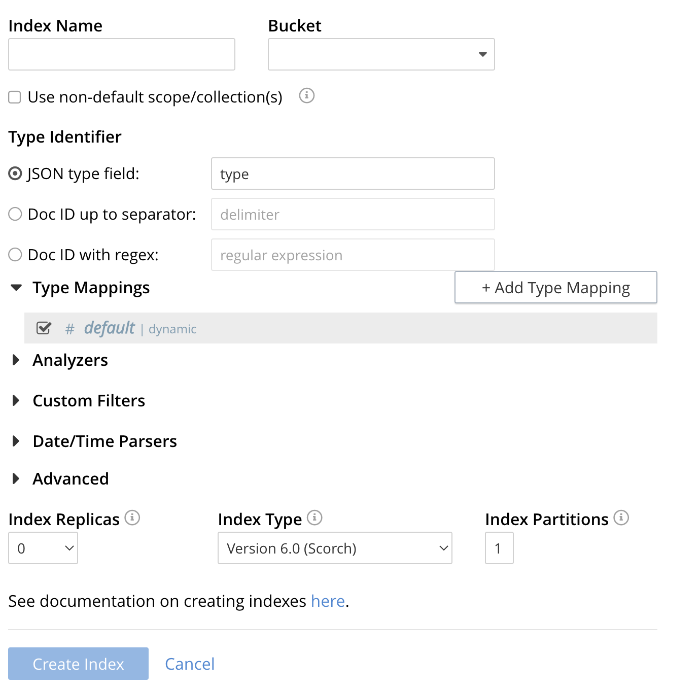
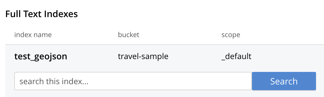
Click the Add Index link in the upper right of the Couchbase Web Console > Search page.
-
To define any index on which Full Text Search a unique name for the index in the Index Name field, on the upper-left. Note that only alphanumeric characters, hyphens, and underscores are allowed for index names and the first character of the name must be alphabetic.
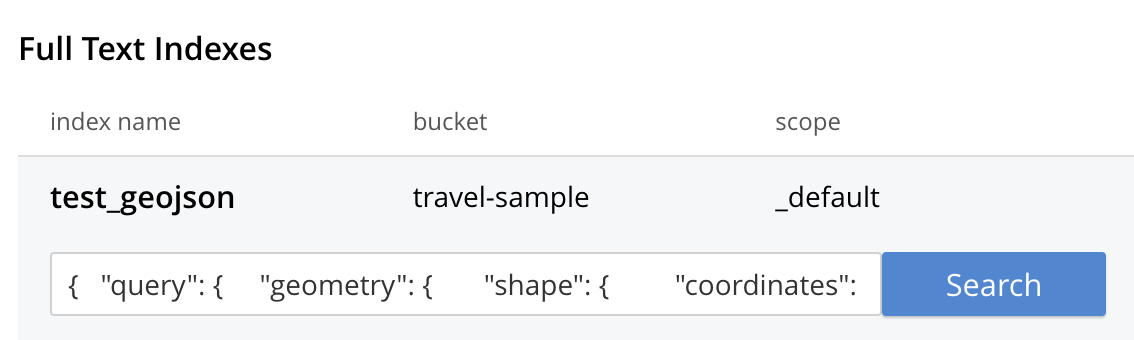
Enter test_geopoint as the name of the Search index you are creating in the Index Name text-box.
-
Select the bucket travel-sample from the Bucket pull-down menu.
Use the pull-down menu provided for the Bucket field, on the upper-right, and select a bucket that you are allowed to access to via the cluster’s RBAC settings.
-
Select the checkbox [X] Use non-default scope/collections
This allows your index to stream mutations from one or more non-default collections under the selected bucket and scope.
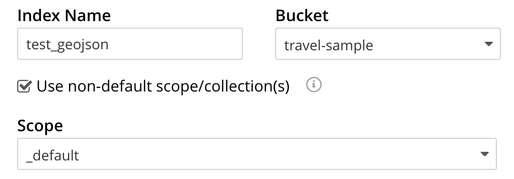
-
You will see a newly visible pull-down menu provided for the Scope field, under the [X] Use non-default scope/collections checkbox, and select a bucket that you are allowed to access to via the cluster’s RBAC settings.
For this example leave the setting as _default which is used to migrate bucket based data into the collections paradigm.
-
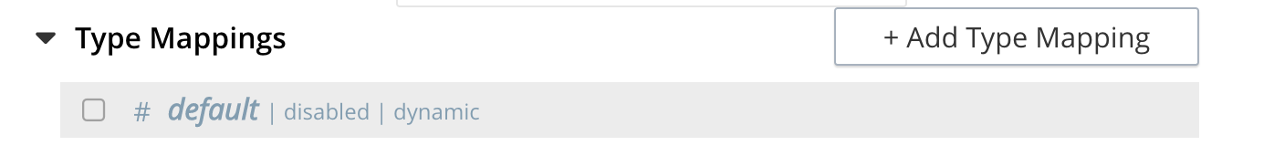
Under Type Mapings, unselect the checkbox [ ] default | dynamic.
This is required as this type mapping (the default mapping) is only valid for the <bucket>._default._default which is typically used to upgrade a 6.X server from a bucket into a more powerful collections paradigm. In this example we will do the equivalent but on a per collections basis.
-
Click on the button + Add Type Mapping
-
A new section with a Collection pull-down, Analyzer pull-down and a [ ] only index specified fields checkbox will appear.
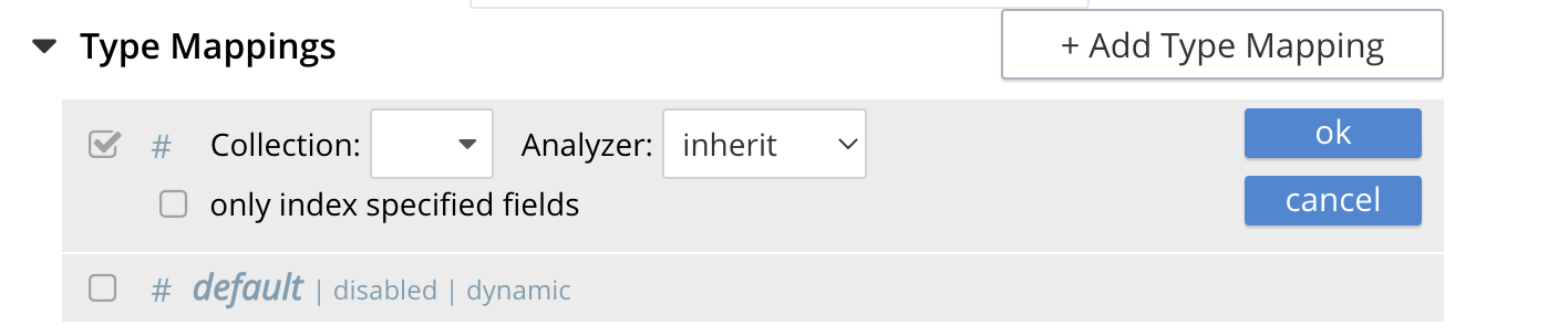
-
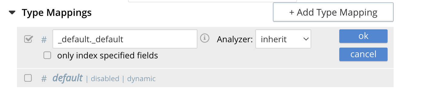
Select _default from the Collection pull-down, note the pull down will change to a text field prefilled with _default._default
-
Leave the [ ] only index specified fields checkbox blank or unset.
This will index all fields in the scope _default collection _default, however not this is not recommended for large production datasets.
-
Click on the blue ok at the right of the section to save this mapping.
-
Hover over your newly created/saved row
-
Click on the blue + button the right side of the row.
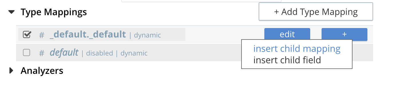
-
A context menu of "insert child mapping" (for sub-objects) and "insert child field" (for properties) will appear.
-
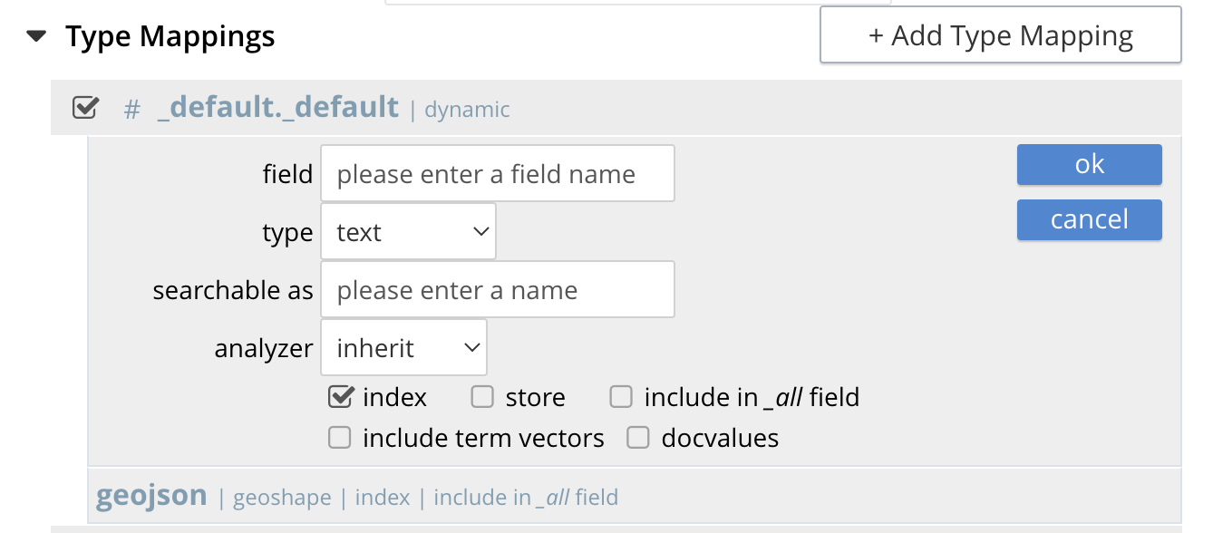
Select insert child field
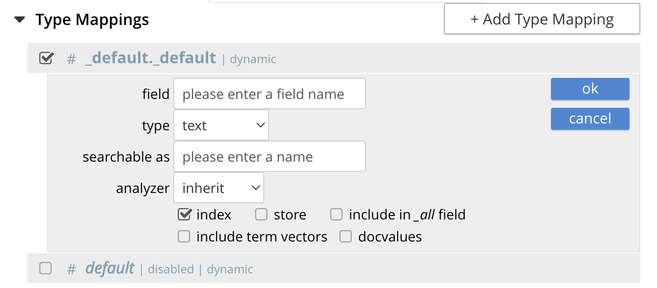
-
another row menu will appear with the following controls: "field", "type", "text", "searchable as", "analyzer" "inherit", "index", "store", "include in _all field", "include term vectors", and "docvalues".
-
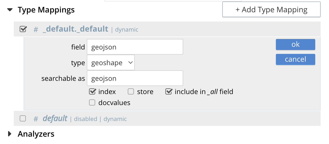
Set the text box field to geojson, this will also update "searchable as" to geojson.
-
Change the pull-down type to geoshape.
By configuring the child field information form, specifically identify the object geo as type geopoint this will tell the Search indexer to recognize top level sub-objects like:
"geojson": { "coordinates": [ 1.954764, 50.962097 ], "type": "Point" }, -
Check [X] the boxes "store" and "include in _all field"
-
Click on the blue ok at the right of the section to save this sub-form.
-
Hover again over the row # _default._default | dynamic
-
Click on the blue + button the right side of the row.
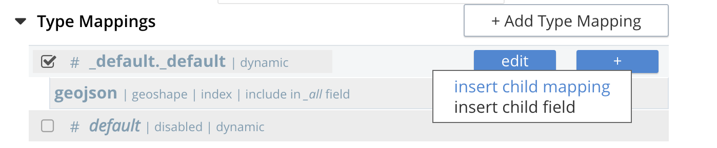
-
A context menu of "insert child mapping" (for sub-objects) and "insert child field" (for properties) will appear.
-
Select insert child field
-
another row menu will appear with the following controls: "field", "type", "text", "searchable as", "analyzer" "inherit", "index", "store", "include in _all field", "include term vectors", and "docvalues".
-
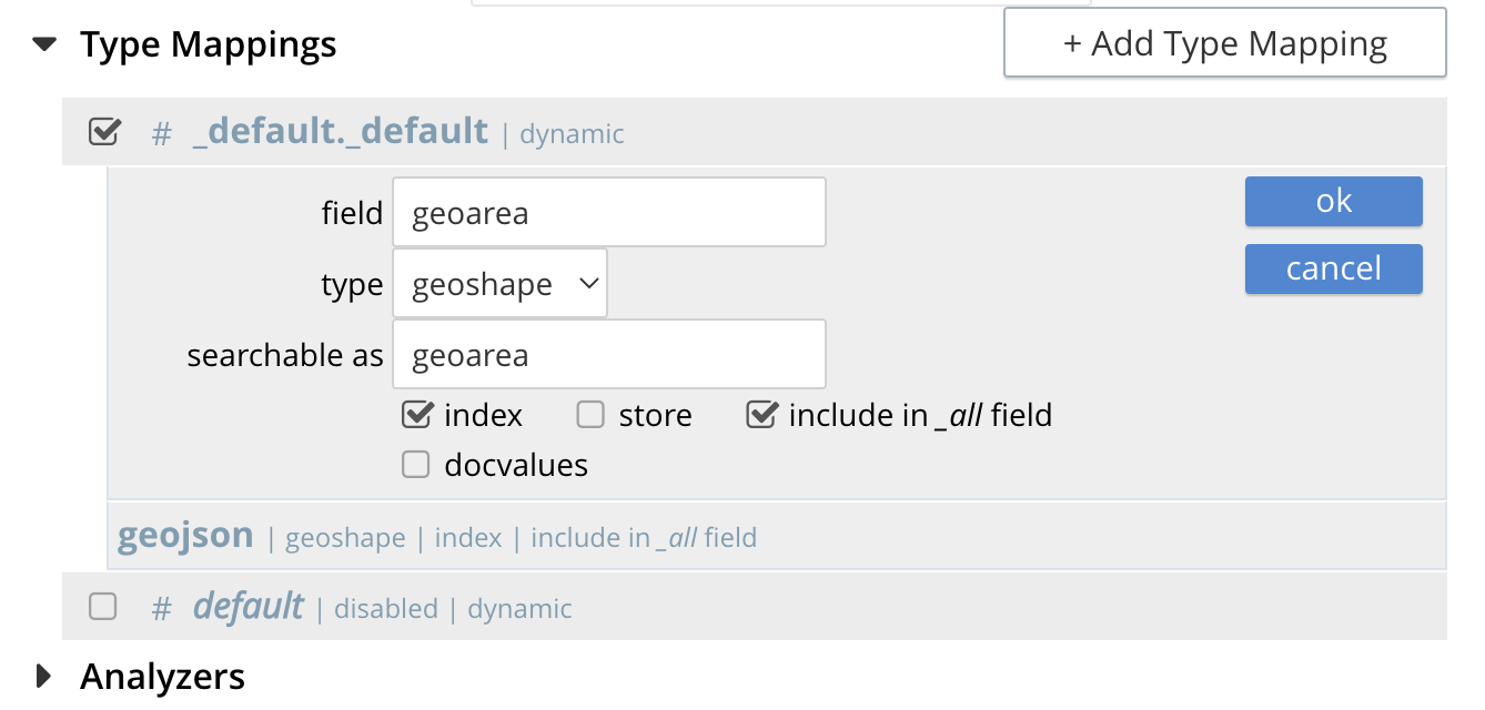
Set the text box field to geoarea, this will also update "searchable as" to geoarea.
-
Change the pull-down type to geoshape.
By configuring the child field information form, specifically identify the object geo as type geopoint this will tell the Search indexer to recognize top level sub-objects like:
"geoarea": { "coordinates": [ 1.954764, 50.962097 ], "radius": "10mi", "type": "circle" }, -
Check [X] the boxes "store" and "include in _all field"
-
Click on the blue ok at the right of the section to save this sub-form.
-
-
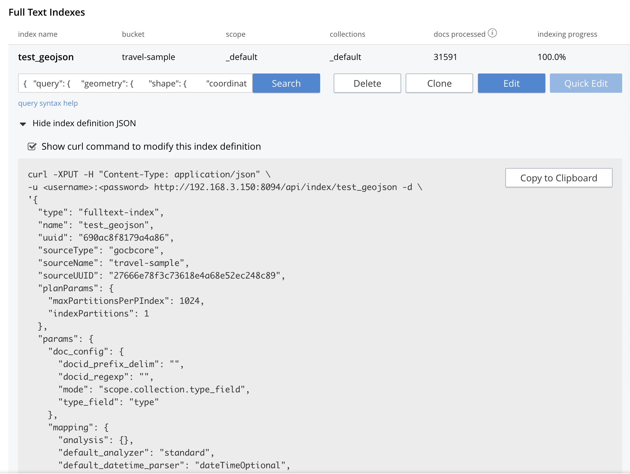
Save your index, left-click on the Create Index button near the bottom of the screen.
This is all you need to specify in order to create a more advanced index for test and development. No further configuration is required.

-
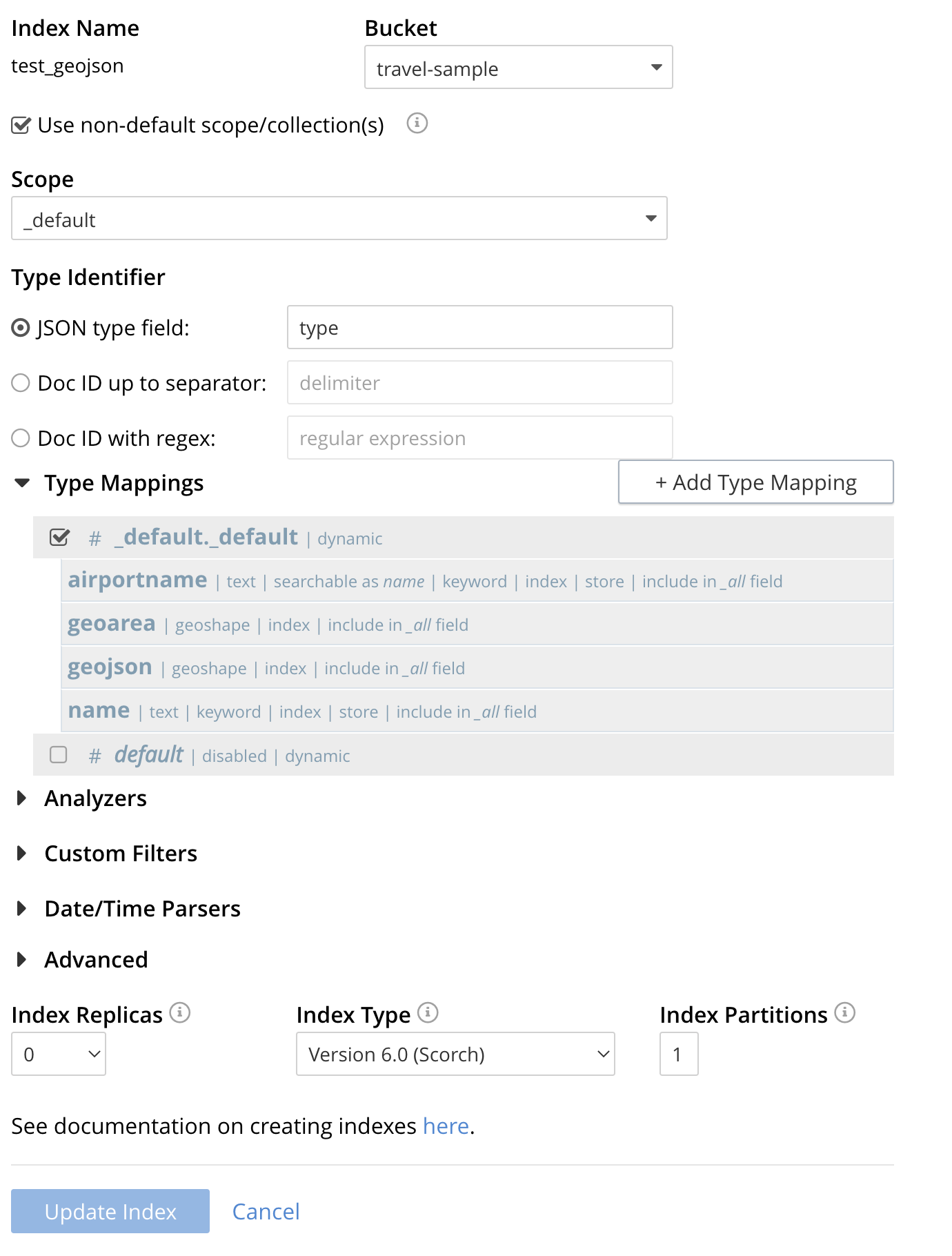
If you subsequently Edit your Index it should look like the following:
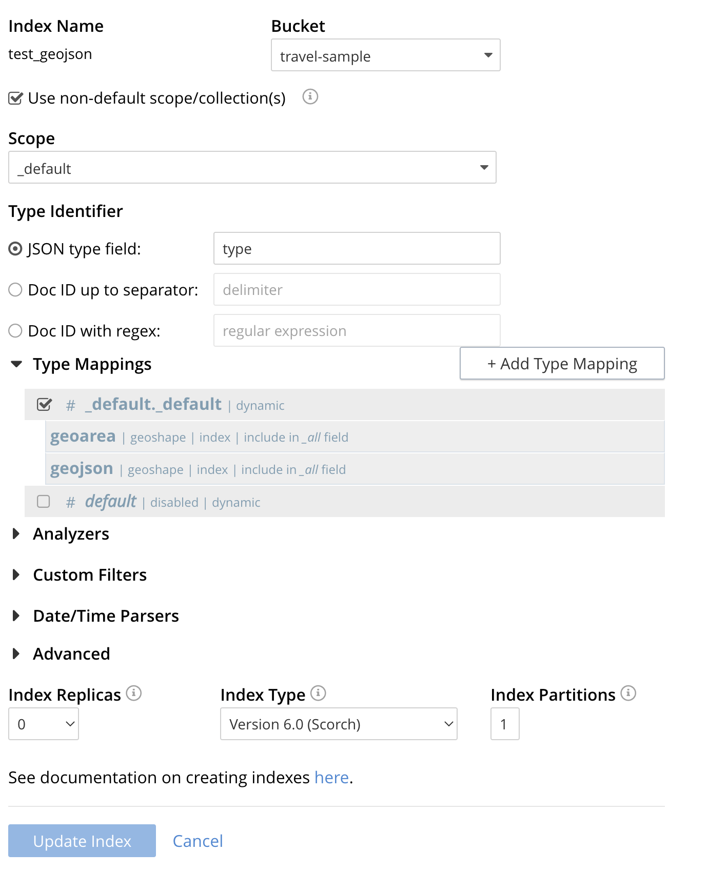
| Indexing all fields as above indexes across all fields is not recommended for production environments since it creates indexes that may be unnecessarily large, and therefore insufficiently performant. However this index can be edited and optimized if you check [X] only index specified fields under the Type Mappings section. This will result in a much smaller index and a faster index build since only the fields geojson and geoarea will be indexed in the set of documents. |
The index once created can also be accessed by means of the Search REST API see Searching with the REST API. Furthermore the index could have been created in the first place via the Search REST API see Index Creation with REST API for more information on using the Search REST API syntax.
Creating a Query: Radius-Based
This section and those following, provide examples of the query-bodies required to make geospatial queries with the Couchbase REST API.
Note that more detailed information on performing queries with the Couchbase REST API can be found in Searching with the REST API; which shows how to use the full curl command and how to incorporate query-bodies into it.
The following query-body specifies a longitude of -2.235143 and a latitude of 53.482358.
The target-field geo is specified, as is a distance of 100 miles: this is the radius within which target-locations must reside for their documents to be returned.
{
  "query": {
    "geometry": {
      "shape": {
        "coordinates": [
          -2.235143,
          53.482358
        ],
        "type": "circle",
        "radius": "100mi"
      },
      "relation": "within"
    },
    "field": "geojson"
  },
  "size": 10,
  "from": 0,
  "sort": [
    {
      "by": "geo_distance",
      "field": "geojson",
      "unit": "mi",
      "location": {
        "lon": -2.235143,
        "lat": 53.482358
      }
    }
  ]
}
The above query contains a sort object, which specifies that the returned documents should be ordered in terms of their geo_distance from specified lon and lat coordinates: these values need not be identical to those specified in the query object.
You can cut-n-paste the above Search body definition into the text area that says "search this index…"
Once pasted hit the Search button and the UI will show the first 10 hits
The console allows searches performed via the UI to be translated dynamically into cURL examples. To create a cURL command to do this first check [X] show advanced query settings and then check [X] show command-line query example.
You should have a cURL command similar to the following:
curl -XPOST -H "Content-Type: application/json" \
-u <username>:<password> http://192.168.3.150:8094/api/index/test_geojson/query \
-d '{
  "query": {
    "geometry": {
      "shape": {
        "coordinates": [
          -2.235143,
          53.482358
        ],
        "type": "circle",
        "radius": "100mi"
      },
      "relation": "within"
    },
    "field": "geojson"
  },
  "size": 10,
  "from": 0,
  "sort": [
    {
      "by": "geo_distance",
      "field": "geojson",
      "unit": "mi",
      "location": {
        "lon": -2.235143,
        "lat": 53.482358
      }
    }
  ]
}'
If you copy and then run the above cURL command via the console the response from the Search service will report that there are 847 total_hits but only return the first 10 hits. A subset of formatted console output might appear as follows:
| To pretty print the response just pipe the output through the utility jq to enhance readability. |
"hits": [
  {
    "index": "test_geojson_690ac8f8179a4a86_4c1c5584",
    "id": "landmark_3604",
    "score": 0.21532348857041025,
    "sort": [
      " \u0001\u007f\u007f\u007f\u007f\u007f\u007f\u007f\u007f\u007f"
    ]
  },
  {
    "index": "test_geojson_690ac8f8179a4a86_4c1c5584",
    "id": "landmark_5571",
    "score": 0.12120554320433605,
    "sort": [
      " \u0001\u007f\u007f\u007f\u007f\u007f\u007f\u007f\u007f\u007f"
    ]
  },
  {
    "index": "test_geojson_690ac8f8179a4a86_4c1c5584",
    "id": "landmark_3577",
    "score": 0.2153234885704102,
    "sort": [
      " \u0001\u007f\u007f\u007f\u007f\u007f\u007f\u007f\u007f\u007f"
    ]
  },
  {
    "index": "test_geojson_690ac8f8179a4a86_4c1c5584",
    "id": "hotel_3606",
    "score": 0.2153234885704102,
    "sort": [
      " \u0001\u007f\u007f\u007f\u007f\u007f\u007f\u007f\u007f\u007f"
    ]
  },
  {
    "index": "test_geojson_690ac8f8179a4a86_4c1c5584",
    "id": "landmark_40167",
    "score": 0.27197802451106445,
    "sort": [
      " \u0001\u007f\u007f\u007f\u007f\u007f\u007f\u007f\u007f\u007f"
    ]
  },
  {
    "index": "test_geojson_690ac8f8179a4a86_4c1c5584",
    "id": "landmark_36152",
    "score": 0.12120554320433605,
    "sort": [
      " \u0001\u007f\u007f\u007f\u007f\u007f\u007f\u007f\u007f\u007f"
    ]
  },
  {
    "index": "test_geojson_690ac8f8179a4a86_4c1c5584",
    "id": "landmark_11329",
    "score": 0.12120554320433605,
    "sort": [
      " \u0001\u007f\u007f\u007f\u007f\u007f\u007f\u007f\u007f\u007f"
    ]
  },
  {
    "index": "test_geojson_690ac8f8179a4a86_4c1c5584",
    "id": "hotel_3643",
    "score": 0.2153234885704102,
    "sort": [
      " \u0001\u007f\u007f\u007f\u007f\u007f\u007f\u007f\u007f\u007f"
    ]
  },
  {
    "index": "test_geojson_690ac8f8179a4a86_4c1c5584",
    "id": "landmark_40038",
    "score": 0.27197802451106445,
    "sort": [
      " \u0001\u007f\u007f\u007f\u007f\u007f\u007f\u007f\u007f\u007f"
    ]
  },
  {
    "index": "test_geojson_690ac8f8179a4a86_4c1c5584",
    "id": "airport_565",
    "score": 0.12120554320433605,
    "sort": [
      " \u0001\u007f\u007f\u007f\u007f\u007f\u007f\u007f\u007f\u007f"
    ]
  }
]
Creating a Query: Envelope (or Rectangle-Based)
In the following query-body, the top_left of a rectangle is expressed by means of an Envelope, specifying [[minLon, maxLat], [maxLon, minLat]] = [[-2.235143, 53.482358],[28.955043, 40.991862]]
The results are specified to be sorted on name alone, since only type hotel and landmark have a name the sort will occur on the tokenized values (they analyzer would need to be type keyword to sort on the actual field names).
{
  "query": {
    "geometry": {
      "shape": {
        "coordinates": [
          [-2.235143, 53.482358],
          [28.955043, 40.991862]
        ],
        "type": "envelope"
      },
      "relation": "within"
    },
    "field": "geojson"
  },
  "sort": ["name"],
  "size": 10,
  "from": 0
}
A subset of formatted output might appear as follows:
"hits": [
  {
    "index": "test_geojson_3dd53eb1ac88768c_4c1c5584",
    "id": "landmark_3604",
    "score": 0.004703467956838207,
    "sort": [
      "ô¿¿ô¿¿ô¿¿"
    ]
  },
  {
    "index": "test_geojson_3dd53eb1ac88768c_4c1c5584",
    "id": "landmark_6067",
    "score": 0.004703467956838207,
    "sort": [
      "ô¿¿ô¿¿ô¿¿"
    ]
  },
  {
    "index": "test_geojson_3dd53eb1ac88768c_4c1c5584",
    "id": "landmark_16320",
    "score": 0.004703467956838207,
    "sort": [
      "ô¿¿ô¿¿ô¿¿"
    ]
  },
If we added two (2) more child field into the Index definition as follows where both items are searchable as "name"
The sort would be on the actual airportname and name fields and the query itself would return these values.
"hits": [
  {
    "index": "test_geojson_4391b0a68d5cc865_4c1c5584",
    "id": "hotel_1364",
    "score": 0.05896334942635901,
    "sort": [
      "'La Mirande Hotel"
    ]
  },
  {
    "index": "test_geojson_4391b0a68d5cc865_4c1c5584",
    "id": "landmark_16144",
    "score": 0.004703467956838207,
    "sort": [
      "02 Shepherd's Bush Empire"
    ]
  },
  {
    "index": "test_geojson_4391b0a68d5cc865_4c1c5584",
    "id": "landmark_16181",
    "score": 0.004703467956838207,
    "sort": [
      "2 Willow Road"
    ]
  },
  {
    "index": "test_geojson_4391b0a68d5cc865_4c1c5584",
    "id": "landmark_16079",
    "score": 0.004703467956838207,
    "sort": [
      "20 Fenchurch Street"
    ]
  },
Creating a Query: Polygon-Based
The following query-body uses an array, each of whose elements is a string, containing multiple floating-point number pairs; to specify the longitude and latitude of each of the lon/lat pairs of a polygon — known as polygon points.
In all cases, the lon floating-point value precedes the lat for the correct GeoJSON winding.
Here, the last-specified pair in the array is identical to the initial pair, thus explicitly closing the polygon. However, specifying an explicit closure in this way is optional: closure will be inferred by Couchbase Server if not explicitly specified.
If a target data-location falls within the polygon, its document is returned.
Request the first 10 items within the state of Utah (note the query body consists of simple set of hand drawn set of corner points).
The target-field geojson is specified, to be compared to the query Polygon the target-locations must reside for their documents to be returned.
Don’t worry about newlines when you paste the text.
The results are specified to be sorted on name alone, since only type hotel and landmark have a name the sort will occur on the tokenized values (they analyzer would need to be type keyword to sort on the actual field names).
{
  "query": {
    "geometry": {
      "shape": {
        "coordinates": [
          [
            [-114.027099609375, 42.00848901572399],
            [-114.04907226562499, 36.99377838872517],
            [-109.05029296875, 36.99377838872517],
            [-109.05029296875, 40.98819156349393],
            [-111.060791015625, 40.98819156349393],
            [-111.02783203125, 42.00848901572399],
            [-114.027099609375, 42.00848901572399]
          ]
        ],
        "type": "Polygon"
      },
      "relation": "within"
    },
    "field": "geojson"
  },
  "size": 10,
  "from": 0,
  "sort": ["name"]
}
A subset of formatted output might appear as follows:
"hits": [
  {
    "index": "test_geojson_4330cb585620d5e8_4c1c5584",
    "id": "airport_7857",
    "score": 0.27669394470240527,
    "sort": [
      "ô¿¿ô¿¿ô¿¿"
    ]
  },
  {
    "index": "test_geojson_4330cb585620d5e8_4c1c5584",
    "id": "airport_7581",
    "score": 0.13231342774148913,
    "sort": [
      "ô¿¿ô¿¿ô¿¿"
    ]
  },
  {
    "index": "test_geojson_4330cb585620d5e8_4c1c5584",
    "id": "airport_7727",
    "score": 0.27669394470240527,
    "sort": [
      "ô¿¿ô¿¿ô¿¿"
    ]
  },
  {
    "index": "test_geojson_4330cb585620d5e8_4c1c5584",
    "id": "airport_9279",
    "score": 0.27669394470240527,
    "sort": [
      "ô¿¿ô¿¿ô¿¿"
    ]
  },
Again if we added two (2) more child field into the Index definition as follows where both items are searchable as "name"
The sort would be on the actual airportname and name fields (but there are only airports returned) and the query itself would return these values.
"hits": [
  {
    "index": "test_geojson_4391b0a68d5cc865_4c1c5584",
    "id": "airport_6999",
    "score": 0.13231342774148913,
    "sort": [
      "Brigham City"
    ]
  },
  {
    "index": "test_geojson_4391b0a68d5cc865_4c1c5584",
    "id": "airport_7857",
    "score": 0.27669394470240527,
    "sort": [
      "Bryce Canyon"
    ]
  },
  {
    "index": "test_geojson_4391b0a68d5cc865_4c1c5584",
    "id": "airport_7074",
    "score": 0.13231342774148913,
    "sort": [
      "Canyonlands Field"
    ]
  },
This example quickly creates the same index as Creating a GeoJSON Index via the REST API. Note it has the two (2) additional child field definitions to allow keyword sorting.
Final GeoJSON Search index
Note, for the samples above that return actual airportname and name fields and also the nine (9) QueryShape examples referenced in Detailed examples for every QueryShape
the Search index used is as follows:
{
  "type": "fulltext-index",
  "name": "test_geojson",
  "sourceType": "gocbcore",
  "sourceName": "travel-sample",
  "planParams": {
    "maxPartitionsPerPIndex": 1024,
    "indexPartitions": 1
  },
  "params": {
    "doc_config": {
      "docid_prefix_delim": "",
      "docid_regexp": "",
      "mode": "scope.collection.type_field",
      "type_field": "type"
    },
    "mapping": {
      "analysis": {},
      "default_analyzer": "standard",
      "default_datetime_parser": "dateTimeOptional",
      "default_field": "_all",
      "default_mapping": {
        "dynamic": true,
        "enabled": false
      },
      "default_type": "_default",
      "docvalues_dynamic": false,
      "index_dynamic": true,
      "store_dynamic": false,
      "type_field": "_type",
      "types": {
        "_default._default": {
          "dynamic": true,
          "enabled": true,
          "properties": {
            "airportname": {
              "dynamic": false,
              "enabled": true,
              "fields": [
                {
                  "analyzer": "keyword",
                  "include_in_all": true,
                  "index": true,
                  "name": "name",
                  "store": true,
                  "type": "text"
                }
              ]
            },
            "geoarea": {
              "dynamic": false,
              "enabled": true,
              "fields": [
                {
                  "include_in_all": true,
                  "index": true,
                  "name": "geoarea",
                  "type": "geoshape"
                }
              ]
            },
            "geojson": {
              "dynamic": false,
              "enabled": true,
              "fields": [
                {
                  "include_in_all": true,
                  "index": true,
                  "name": "geojson",
                  "type": "geoshape"
                }
              ]
            },
            "name": {
              "dynamic": false,
              "enabled": true,
              "fields": [
                {
                  "analyzer": "keyword",
                  "include_in_all": true,
                  "index": true,
                  "name": "name",
                  "store": true,
                  "type": "text"
                }
              ]
            }
          }
        }
      }
    },
    "store": {
      "indexType": "scorch",
      "segmentVersion": 15
    }
  },
  "sourceParams": {}
}
If viewed in the UI: